THE DAY THE EARTH CAUGHT DATA (E1)
2023
The Day the Earth Caught Data unfolds in a
series of several episodes that attempt to create fictional narratives using
found online material from different locations. The episodes draw
parallels between a widely shared, seemingly uncomplicated reality and a
troublesome fiction where the image-makers become storytellers of their own
unsettling future.
Constant surveillance practices on Earth’s surface
necessitate AI technologies to facilitate the frequent use of mapping apps and
the incessant sharing of locations along with self-referential content. These
procedures require huge amount of data which contributes significantly in the
digital footprint.
The title
is a reference to post-apocalyptic film “The Day the Earth Caught Fire” (1961) and each episode suggests a dystopia, an aftermath of the
intense human presence and the constant use of digital media that accompanies
it, wondering if the end of the world will come from our own visual
representations.
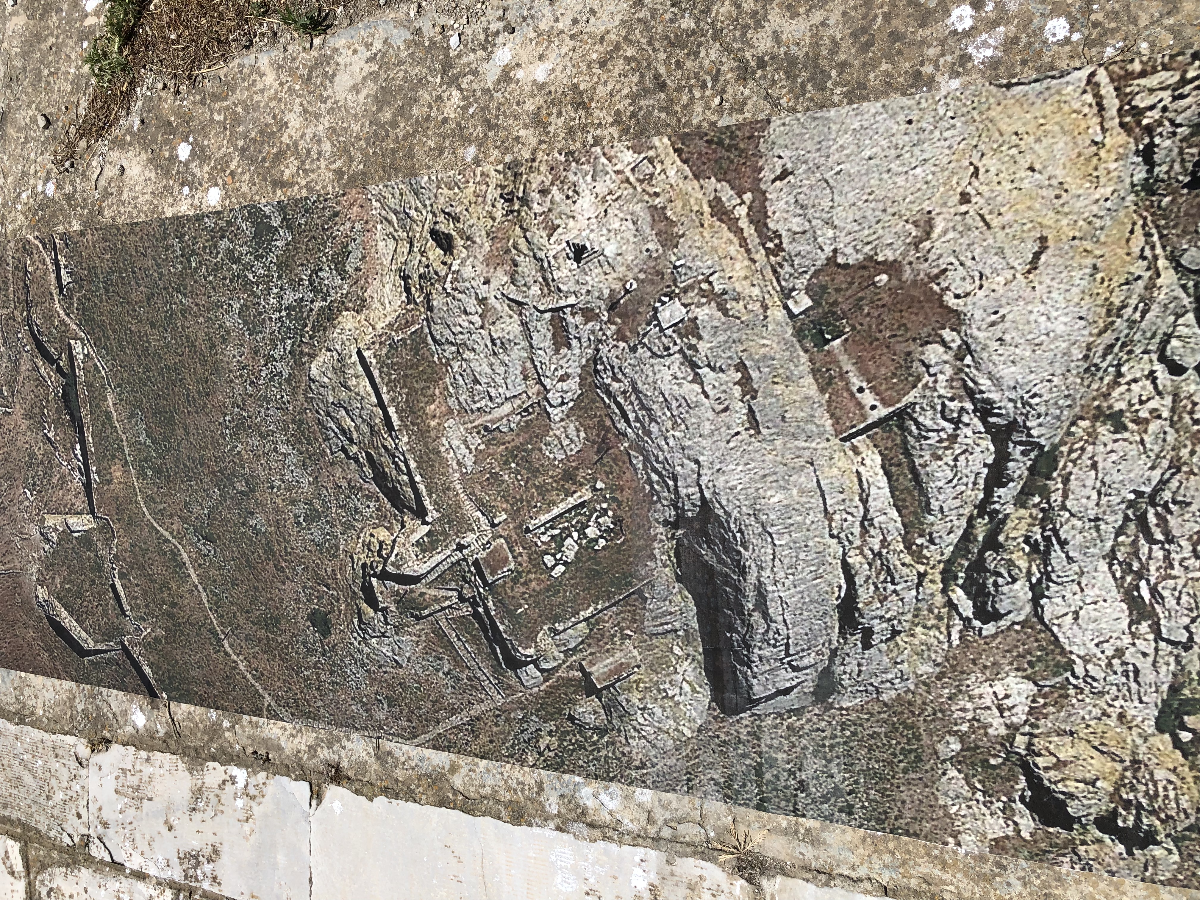
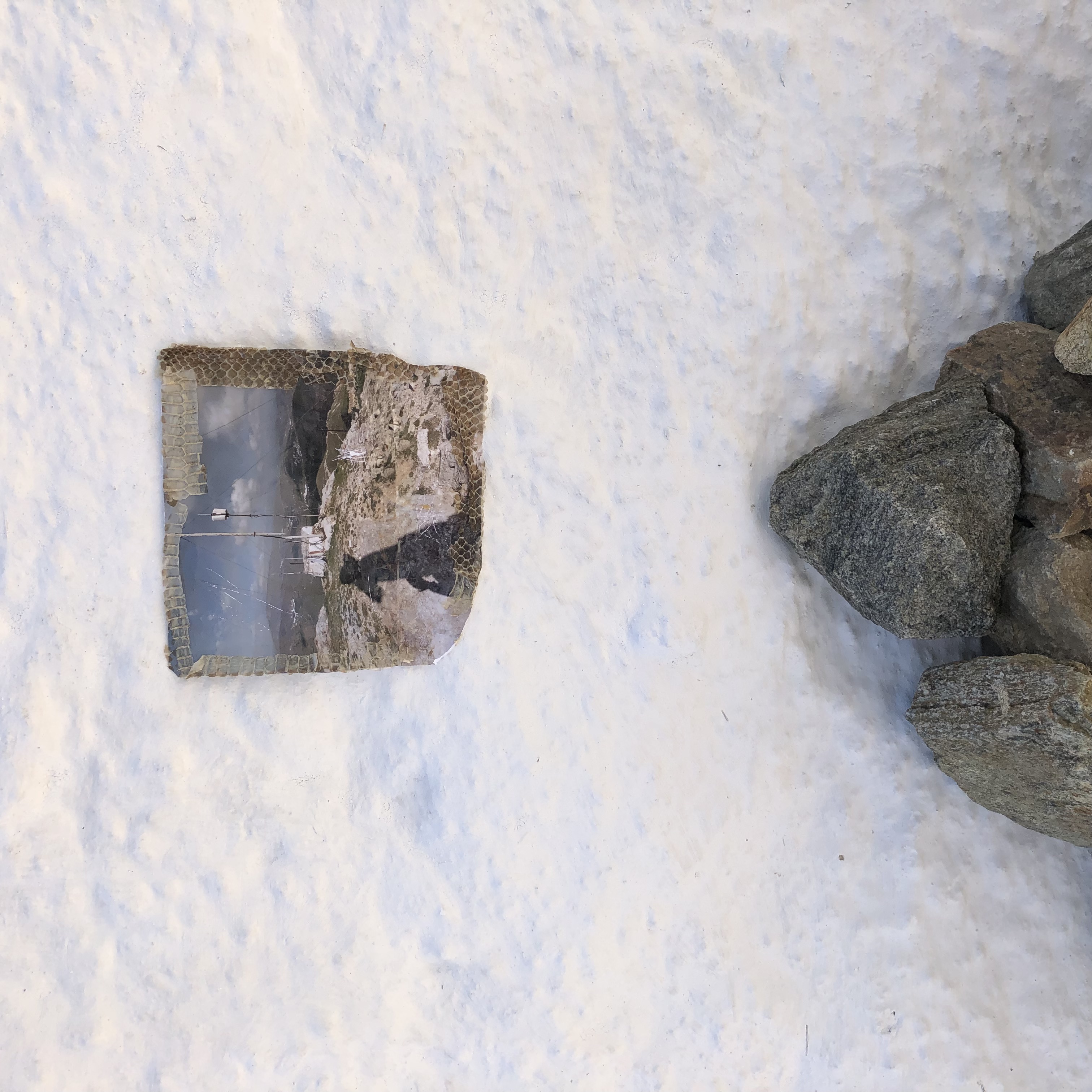
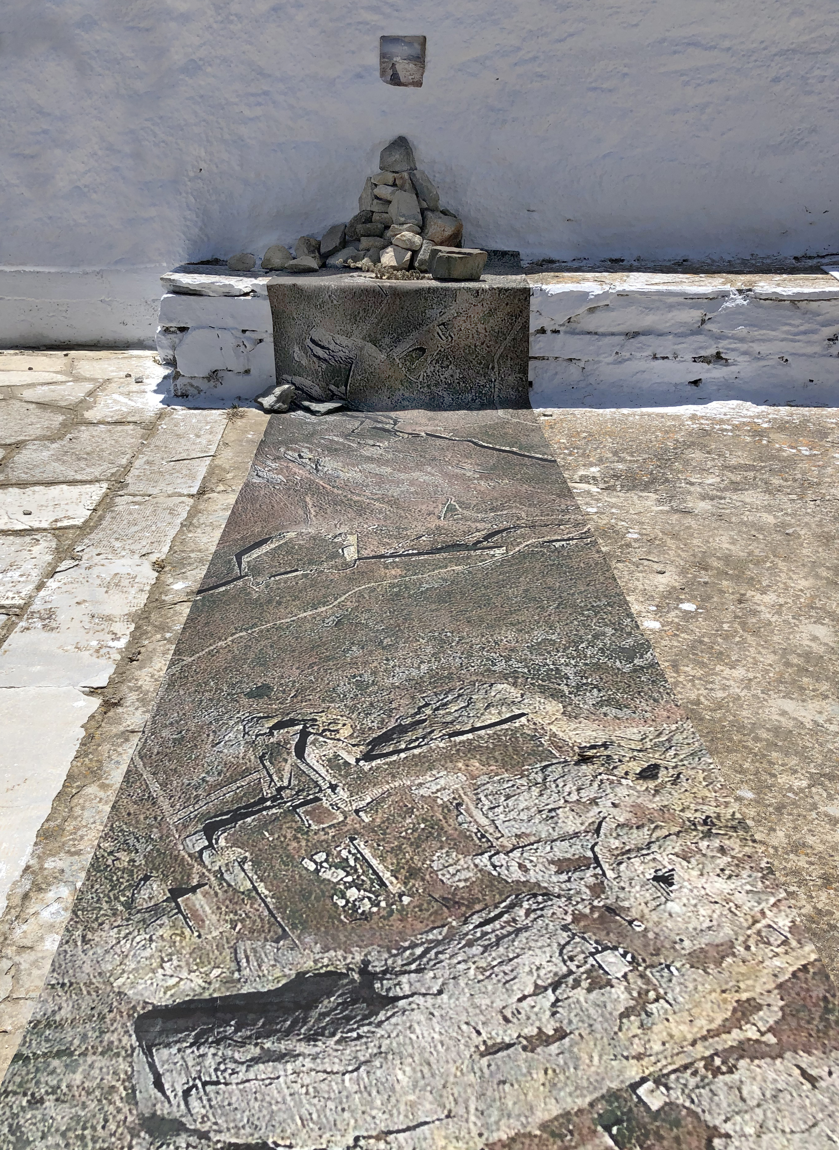
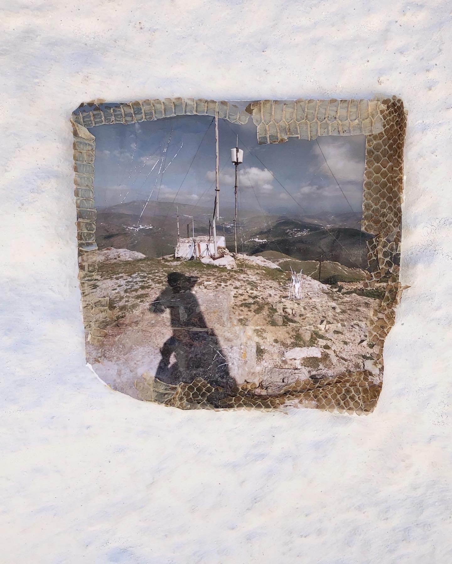
Episode 1 of The Day the Earth Caught Data was a site-specific installation in the island of Tinos. It consisted of Google Earth satellite images of the area of Exobourgo in
Tinos and a screenshot of shared users’ photos in Google Street View Photosphere. The work brings attention to the prominence of the specific location and the
multiple references it carries through the traces of ancient ruins, religious symbols,
satellite antennas, and other human interventions and signals. The installation
simulates a sanctuary that has been created by the last remnants of humankind to
appease nature or perhaps to declare their presence there inscribing a final
imprint or even performing an ultimate attempt of communication.
The Day the Earth Caught Data unfolds in a series of several episodes that attempt to create fictional narratives using found online material from different locations. The episodes draw parallels between a widely shared, seemingly uncomplicated reality and a troublesome fiction where the image-makers become storytellers of their own unsettling future.
Constant surveillance practices on Earth’s surface necessitate AI technologies to facilitate the frequent use of mapping apps and the incessant sharing of locations along with self-referential content. These procedures require huge amount of data which contributes significantly in the digital footprint.
The title is a reference to post-apocalyptic film “The Day the Earth Caught Fire” (1961) and each episode suggests a dystopia, an aftermath of the intense human presence and the constant use of digital media that accompanies it, wondering if the end of the world will come from our own visual representations.
Episode 1 of The Day the Earth Caught Data was a site-specific installation in the island of Tinos. It consisted of Google Earth satellite images of the area of Exobourgo in Tinos and a screenshot of shared users’ photos in Google Street View Photosphere. The work brings attention to the prominence of the specific location and the multiple references it carries through the traces of ancient ruins, religious symbols, satellite antennas, and other human interventions and signals. The installation simulates a sanctuary that has been created by the last remnants of humankind to appease nature or perhaps to declare their presence there inscribing a final imprint or even performing an ultimate attempt of communication.