THE DAY THE EARTH CAUGHT DATA (E3)
2024

The Day the Earth Caught Data unfolds in a
series of several episodes that attempt to create fictional narratives using
found online material from different locations. The episodes draw
parallels between a widely shared, seemingly uncomplicated reality and a
troublesome fiction where the image-makers become storytellers of their own
unsettling future.
Constant surveillance practices on Earth’s surface
necessitate AI technologies to facilitate the frequent use of mapping apps and
the incessant sharing of locations along with self-referential content. These
procedures require huge amount of data which contributes significantly in the
digital footprint. The title
is a reference to post-apocalyptic film “The Day the Earth Caught Fire” (1961) and each episode suggests a dystopia, an aftermath of the
intense human presence and the constant use of digital media that accompanies
it, wondering if the end of the world will come from our own visual
representations.
The Day the Earth Caught Data unfolds in a
series of several episodes that attempt to create fictional narratives using
found online material from different locations. The episodes draw
parallels between a widely shared, seemingly uncomplicated reality and a
troublesome fiction where the image-makers become storytellers of their own
unsettling future.
Constant surveillance practices on Earth’s surface necessitate AI technologies to facilitate the frequent use of mapping apps and the incessant sharing of locations along with self-referential content. These procedures require huge amount of data which contributes significantly in the digital footprint. The title is a reference to post-apocalyptic film “The Day the Earth Caught Fire” (1961) and each episode suggests a dystopia, an aftermath of the intense human presence and the constant use of digital media that accompanies it, wondering if the end of the world will come from our own visual representations.
Constant surveillance practices on Earth’s surface necessitate AI technologies to facilitate the frequent use of mapping apps and the incessant sharing of locations along with self-referential content. These procedures require huge amount of data which contributes significantly in the digital footprint. The title is a reference to post-apocalyptic film “The Day the Earth Caught Fire” (1961) and each episode suggests a dystopia, an aftermath of the intense human presence and the constant use of digital media that accompanies it, wondering if the end of the world will come from our own visual representations.
.
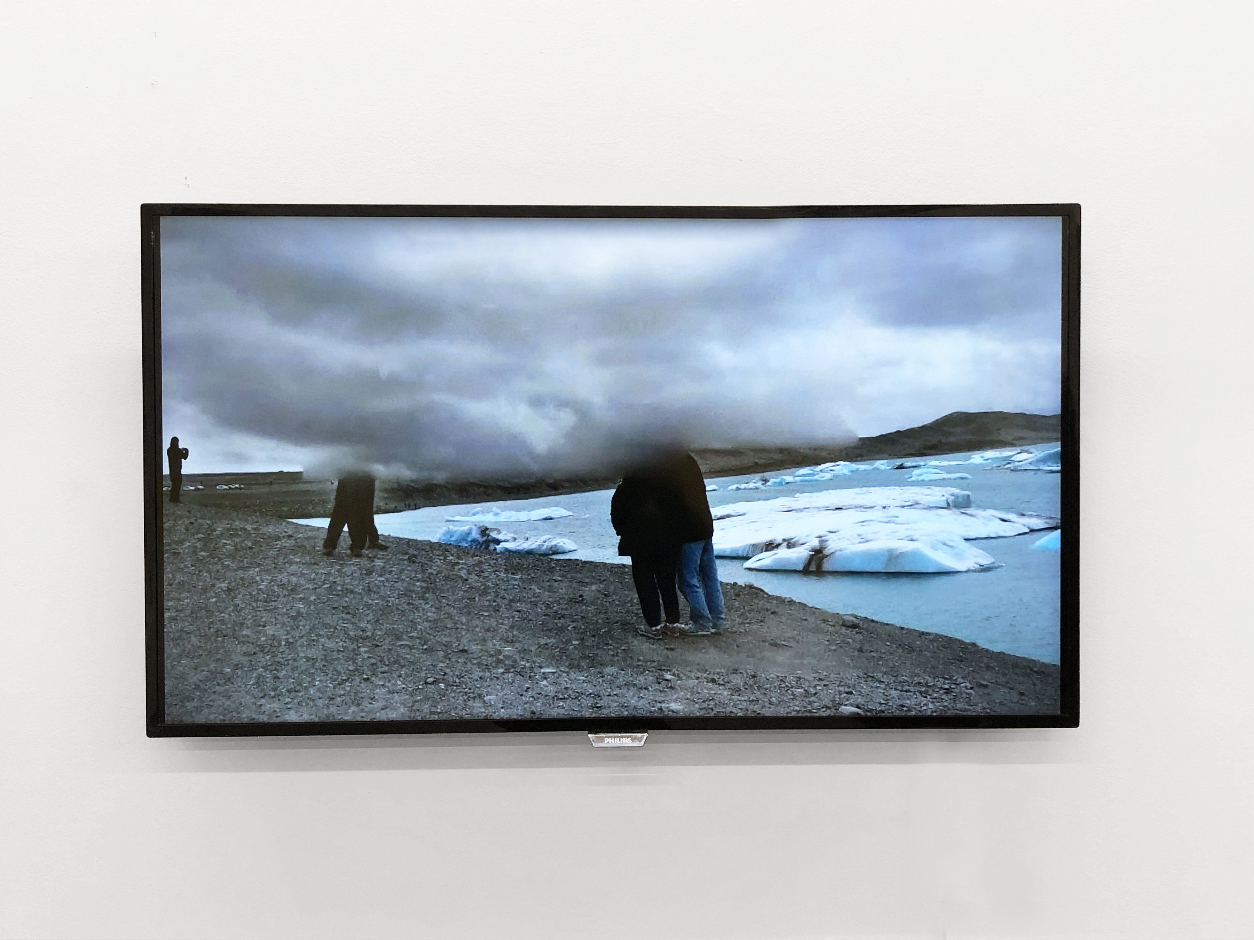

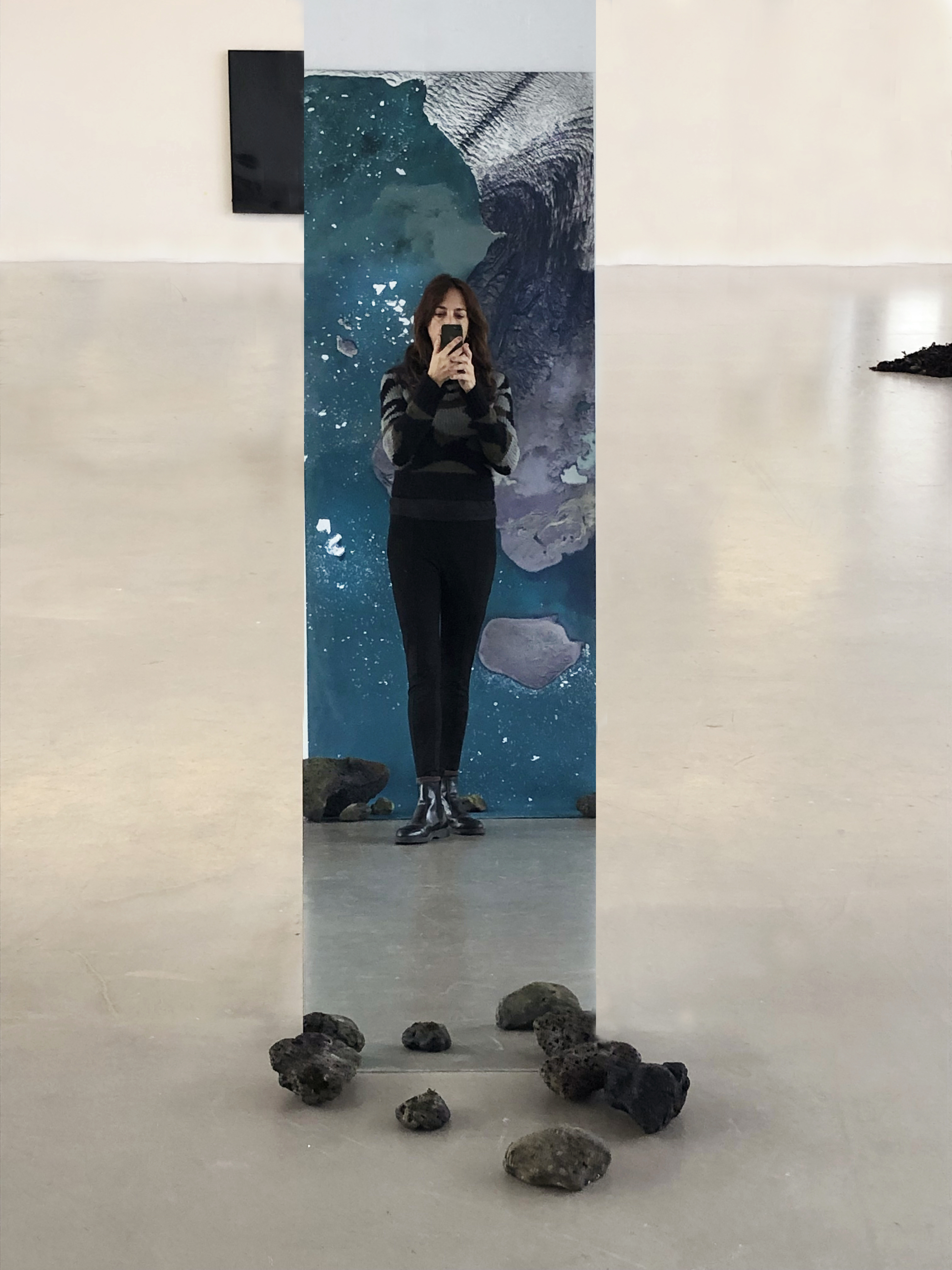
Episode 3 of The Day the Earth Caught Data was an interactive installation involving audience participation using primarily online material shared by different users through Google Street View Photosphere. The research is focused on Jökulsárlón, the famous glacial lake in the southern part of Iceland, which is undergoing unprecedented changes due to global warming. The use of the satellite images generated by Google Earth along with screenshots taken from the online photos shared by the visitors in Google Earth’ Photosphere (view slide show below), construct a different, more dystopian narrative. The landscape resembles that of another planet, or that of a doomsday movie setting, where the individuals strolling around look lost, exhausted and disoriented amidst the melting glaciers and barren, uninviting surroundings. The audience was encouraged to participate, by taking their own selfies on the mirror opposite the printed backdrop.

The Day the Earth Caught Data (E3) was part of the group exhibition “Navigating” at The Living Art Museum, Reykjavik as part of Head2Head Festival, co-curated by Eleni Tsopotou.
Print on canvas (2.80x1.00m. satellite images from Google Earth)
Slideshow on monitor (Screenshots from Photosphere Google Street View)
Mirror (1.50x0.60)
Volcanic stones.
Print on canvas (2.80x1.00m. satellite images from Google Earth)
Slideshow on monitor (Screenshots from Photosphere Google Street View)
Mirror (1.50x0.60)
Volcanic stones.